Plan your bike trip from A to Z, no account, no subscription.
EuroVelo, Loire à Vélo, Canal du Midi, Danube or improvised bikepacking — RunningMap lets you build your multi-stage route, anticipate elevation, and locate water points, accommodation and bike workshops along the way. Free, no ads, no sign-up, on iOS and Android.
Free
No ads
No subscription
Anonymous
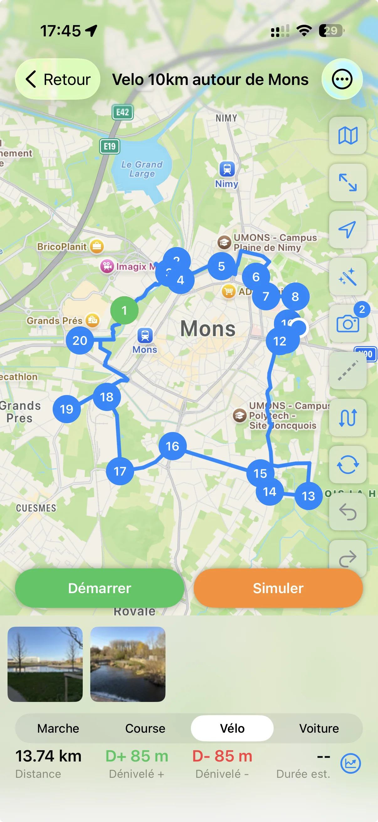
Multi-stage bike trip
Reorderable daily stages
Add each stop of your trip, drag and drop to reorder, remove or insert a last-minute detour. The route recalculates automatically.
Precise waypoints on the map
Tap directly on the map to add a waypoint: a pass to avoid, a greenway to follow, a detour to a winery or a cathedral.
Share with your travel companions
Export the GPX of each stage and send it to your friends via email, WhatsApp or AirDrop. Everyone has the same route, even without the app.
Made for e-bikes
Electric sub-profile
Routing takes e-bike specifics into account: better-tolerated gradients, longer distances allowed, road choices adapted to your battery range.
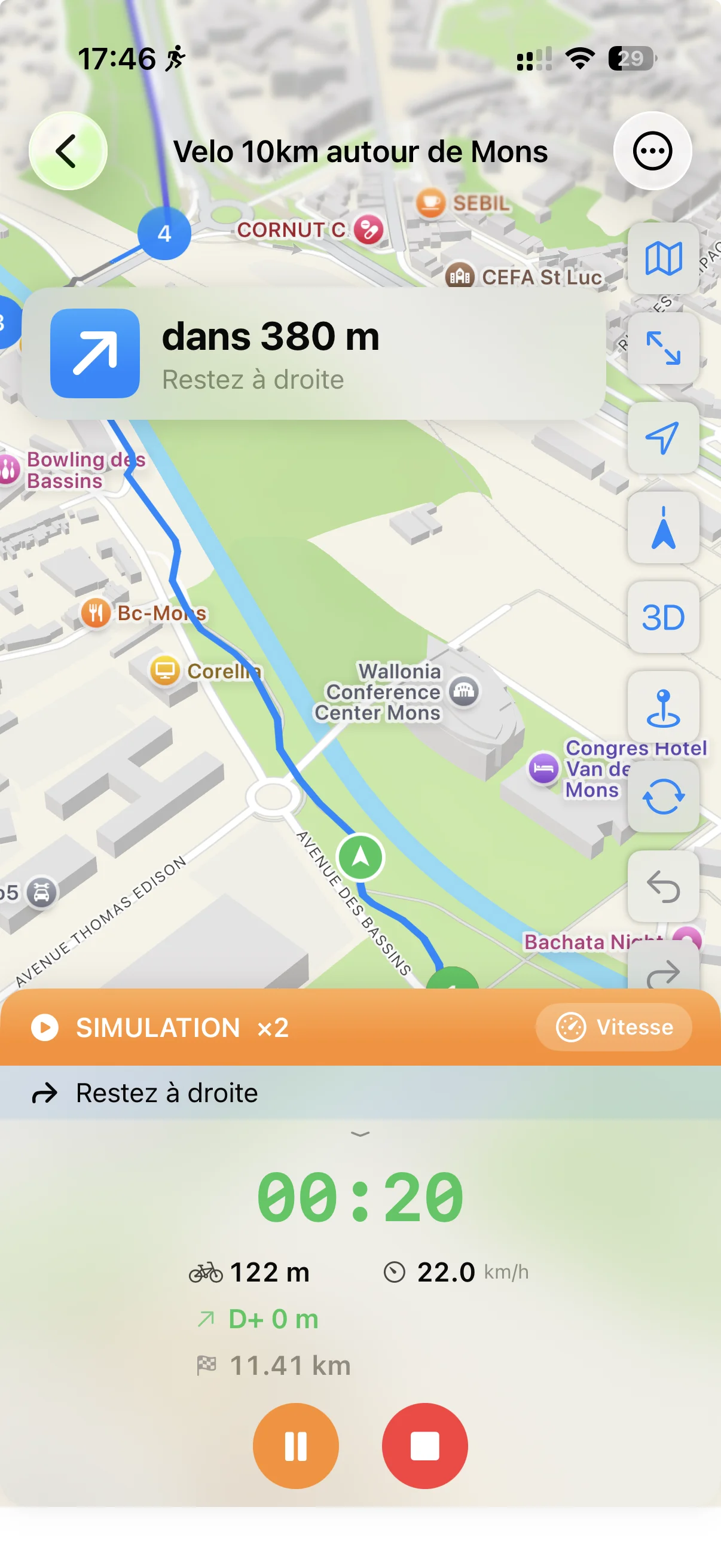
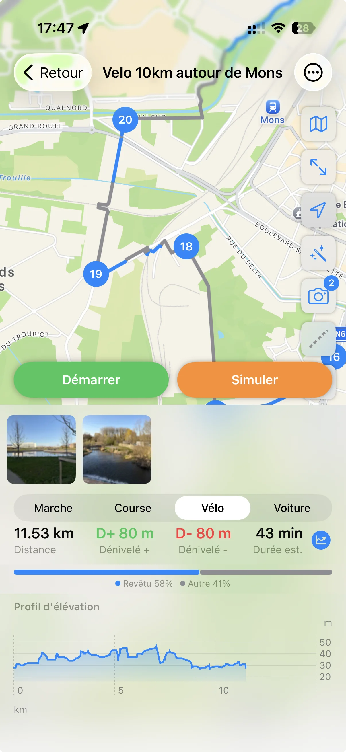
Elevation profile to plan recharging
See the cumulative elevation of each stage before leaving. You know where to ride in eco mode and where you'll need turbo.
Full set of cycling sub-profiles
Standard, Road, MTB, Electric — pick the mode that fits your bike and your style. Routing adapts to bike paths, greenways and small roads.
All the useful POIs on the way
26 filterable categories
Water points, accommodation, restaurants, bike workshops, supermarkets, cafés, pharmacies, public toilets — display only what you need.
Up-to-date OpenStreetMap data
POIs come from the OpenStreetMap community, continuously updated by thousands of contributors across Europe.
Tap any POI for details
Tap any point of interest on the map to see its details (name, type, distance). Spot your potential stops at a glance before you leave, or mid-ride if needed.
Inspiration from the community
Routes shared by other cyclotourists
Discover itineraries published by the RunningMap community: EuroVelo stages, regional crossings, weekend loops, bikepacking runs.
Download and adapt at your pace
Import another traveller's route, then adjust the stages to your taste, your level and the weather. No need to start from scratch.
No account required to browse
You can browse shared routes without creating an account. RunningMap collects no personal data.
Export and share as GPX
Compatible with Garmin and other bike GPS
Export your itinerary as standard GPX and load it onto your Garmin, Wahoo or any other bike navigation app.
Printable for your handlebar bag
Need a paper backup? The GPX can be opened in any mapping tool to produce a printable trace.
Strava compatible
Once your trip is done, your recorded activity exports directly to Strava if you've connected your account.
Save your travel itineraries
Automatic backup
Your itineraries are saved on every change. You can restore them after reinstalling or switching device using a unique identifier you keep yourself.
Local backup on Android
All your routes stay on your phone, exportable as GPX at any time. No forced dependency on any online service.
No risk of losing your trip
No subscription to renew, no service that shuts down: your itineraries are yours and stay accessible for life.